The Digital Pilot
The author of our first DH publication speaks to the merits of born-digital scholarship.
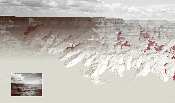
Stanford University Press’s digital publishing initiative will revolutionize how humanities scholars work in web-based media. I make this bold and hopeful statement as the pilot author in the initiative, and therefore from the perspective of a practicing digital humanist. The term digital publishing conjures a variety of possibilities, the most familiar being blogs, electronic books, wikis, or online newspapers and journals. For the past two decades libraries and presses all over—including SUP—have undergone massive restructuring to accommodate these new media. When I reference SUP’s digital publishing initiative as revolutionary, therefore, I am not talking about any of these familiar formats. Scholars engaged in what has become known as the Digital Humanities (DH)—encompassing disciplines as wide-ranging as Literature, History, Cultural Studies, and Geography—have developed a track record of serious engagement with digital media to both formulate new disciplinary questions and to express new theses in compelling ways.
Crucial in understanding this style of scholarship is that the digital part is not coincidental to, but integral to how ideas are made and communicated. What digital humanists are doing is beyond writing articles and books, then digitizing them. Instead, many DH scholars have begun to build digital media (for example, websites) that present their documents, data, interpretations, visualizations, maps, graphs, charts, and conclusions all in a single, often dynamic and interactive, package.
For certain projects with fitting material, this is absolutely wonderful, and it makes complete sense as the digital era ripens to encompass more and more of our daily experience. Why would scholarship, as a genre, not take advantage of a medium of expression that allows, for example, interactivity, dynamic maps, and links among textual content? But the hammer falls: until now, no university press has been willing and/or able to critically peer-review and publish meaningful research projects that are “born-digital.” Because of SUP’s prescient digital publishing initiative, the gap between what DH scholars are making and the established pathways of traditional academic distribution and accreditation is now much, much smaller. Until now, this gap threatened the very survival of DH because there was no incentive for a group of researchers to spend their time building a digital platform to advance their arguments when there was always the looming pressure to do the “real work” of publishing. The SUP initiative is not only an outlet, but a lightning rod, announcing to the academic world that DH is, quite literally, official. The hope that I share with the editors and directors at SUP is that from this point forward you can use digital media to express ideas, and that—just like books—if they are deemed good ideas by professional peer-reviewers and editors, they might be published.
My own foray into the world of digital publishing for humanities scholarship started in March 2012 in the Huntington Library archive. Wholly serendipitously, I discovered and became interested in a series of 43 images made by commercial photographer Henry Peabody at the Grand Canyon around 1900 that he sold as a lantern slideshow around the United States for at least three decades. Over the course of a week, as I slowly began to realize that the negatives for Peabody’s original slideshow existed in scattered locations throughout the collection, I began piecing the slideshow back together, and to my delight all 43 images had survived along with their type-written narrations and original sequencing in Peabody’s mail-order catalog. Many of the original images are 8×10 inch glass plate negatives, offering gorgeous, stunningly clear views from what would become some of the Grand Canyon’s most iconic vista points.
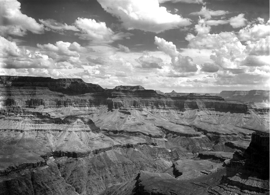
But while no doubt captivating on purely aesthetic grounds, the beauty of the photographs ultimately landed flat for me. Ironically, these striking images obscured something about the space that they captured. Though the serial collection attempts to visually recreate the Grand Canyon, the pictures are disorienting on an individual level; it is nearly impossible for the mind to connect them in geographical space. I was concerned with what I have grown to call the produced space of this group of photographs. What does it mean to be concerned with the produced space of a set of pictures? For me it has meant answering two deceptively simple questions about each picture: first, where was Peabody standing when he took the picture? And second, what, as viewers, are we actually looking at in each picture?
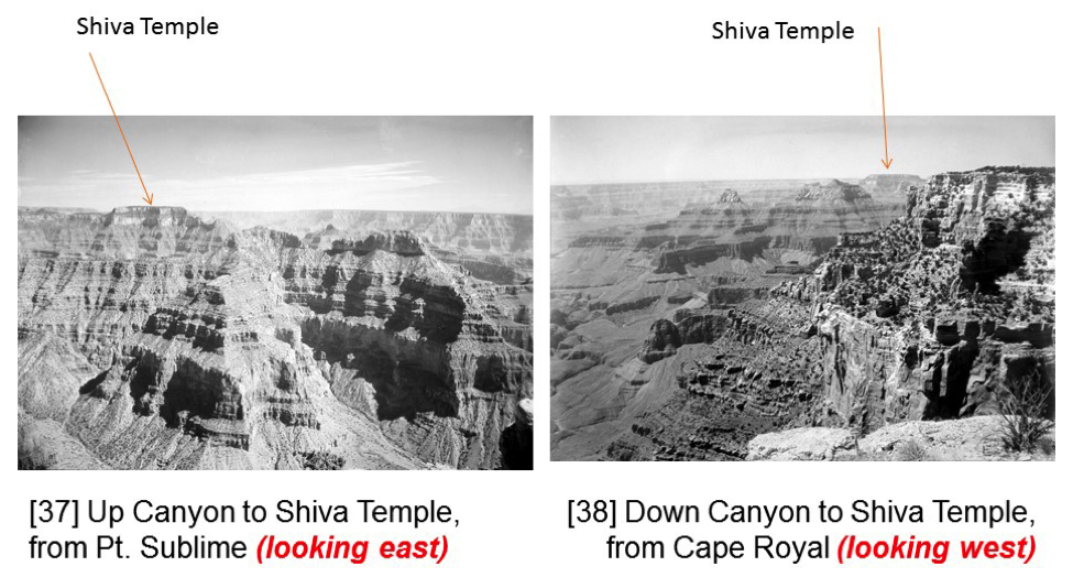
Further, after a few slides they start to look very similar to one another; it is challenging to discern one rock type from another, or to have any sense of the human significance (Native Americans, prospectors, and the U.S. government) of each individual location represented in the photos. In short, the thing that I couldn’t answer from careful analysis of each photograph in succession was how they fit together as a whole—how, when viewed in their original format as a slideshow, they painted not 43 separate portraits of what would soon become America’s most visited National Park, but one portrait of it.
The project that has developed over the past three years—Enchanting the Desert—is my geographical portrayal of Peabody’s slideshow. His is the earliest surviving mass-marketed visual representation of the region, meaning that it serves as a visual template for what people actually saw, and, importantly, what remained visually abandoned, when they gazed out at the Grand Canyon.
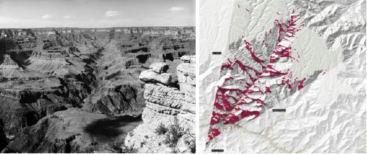
Allowing readers to explore this geography on their own terms—probing each photo and its own peculiar relationship with the other photos, reading in-depth historical examinations of the landmarks being pictured, and learning about this important historical document of the American West in an art historical context—would be unwieldy on paper, but on a digital platform becomes seamlessly navigable.
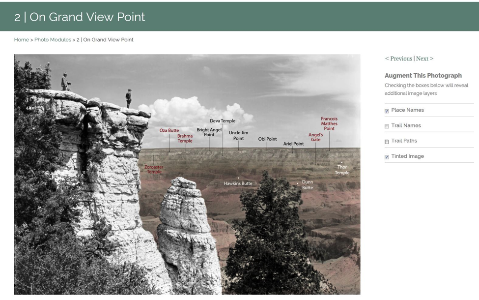
With a team of researchers at the Spatial History Project and the Bill Lane Center for the American West at Stanford University, I have been able to reconstruct Peabody’s Grand Canyon from the god’s-eye view, making geographic sense of what virtual turn-of-the-century tourists were consuming when they consumed a frontier ideology of the West. But this cartographic portrayal of the photographs has opened the door to an arguably even more important aspect of the project, namely the creation of a spatial narrative of the human history of this region, accessible only through the ability to interact with a dynamic set of online tools. On behalf of Stanford University Press, I look forward to sharing this work with you in the coming year. It is an experience of a historical geography of the Grand Canyon that would not be possible without their courageous efforts to publish it as it was designed—digitally.
All photographs are courtesy of The Huntington Library, San Marino, CA.

Nicholas Bauch (@nbbauch) is a postdoctoral scholar with a joint appointment at the Center for Spatial and Textual Analysis and the Bill Lane Center for the American West at Stanford University. He holds a PhD in Geography from UCLA.


“[U]ntil now, no university press has been willing and/or able to critically peer-review and publish meaningful research projects that are “born-digital.”
As a not-so-minor historical quibble, the University of Virginia Press has in fact been doing this since 2004, in its Rotunda imprint (http://www.upress.virginia.edu/rotunda/), whose startup was initially funded by Mellon and UVA. Principal investigator of its original grant proposal was John Unsworth, and he envisioned the Electronic Imprint (as it was then called) to be a peer-reviewed repository for projects much like those being housed at his Institute for Advanced Technology in the Humanities.
For reasons to do largely with the library market and economies of scale, in recent years Rotunda has de-emphasized the acquisition of standalone born-digital DH-like projects and been focusing on our larger aggregrations of content, several of which derive all or part of their content from letterpress editions. But it does grate a bit to see assertions (and you’re not alone in this) that Stanford UP is the first university press to explore this terrain.
That said, Stanford is moving into a niche that UVA Press is moving out of, so in terms of the ecology of scholarly publishing it’s good to have a new and cutting-edge initiative in place.